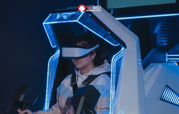
VR360 | Virtual Reality Solutions VR, AR, 3D, 360, Map3D, Metaverse
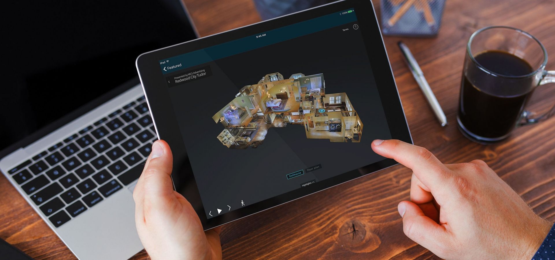


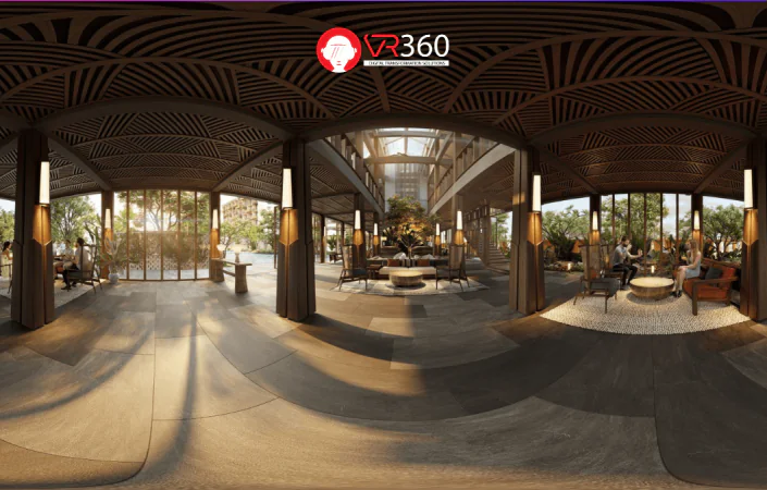
VR360 Virtual Tour

Matterport 3D Scanning

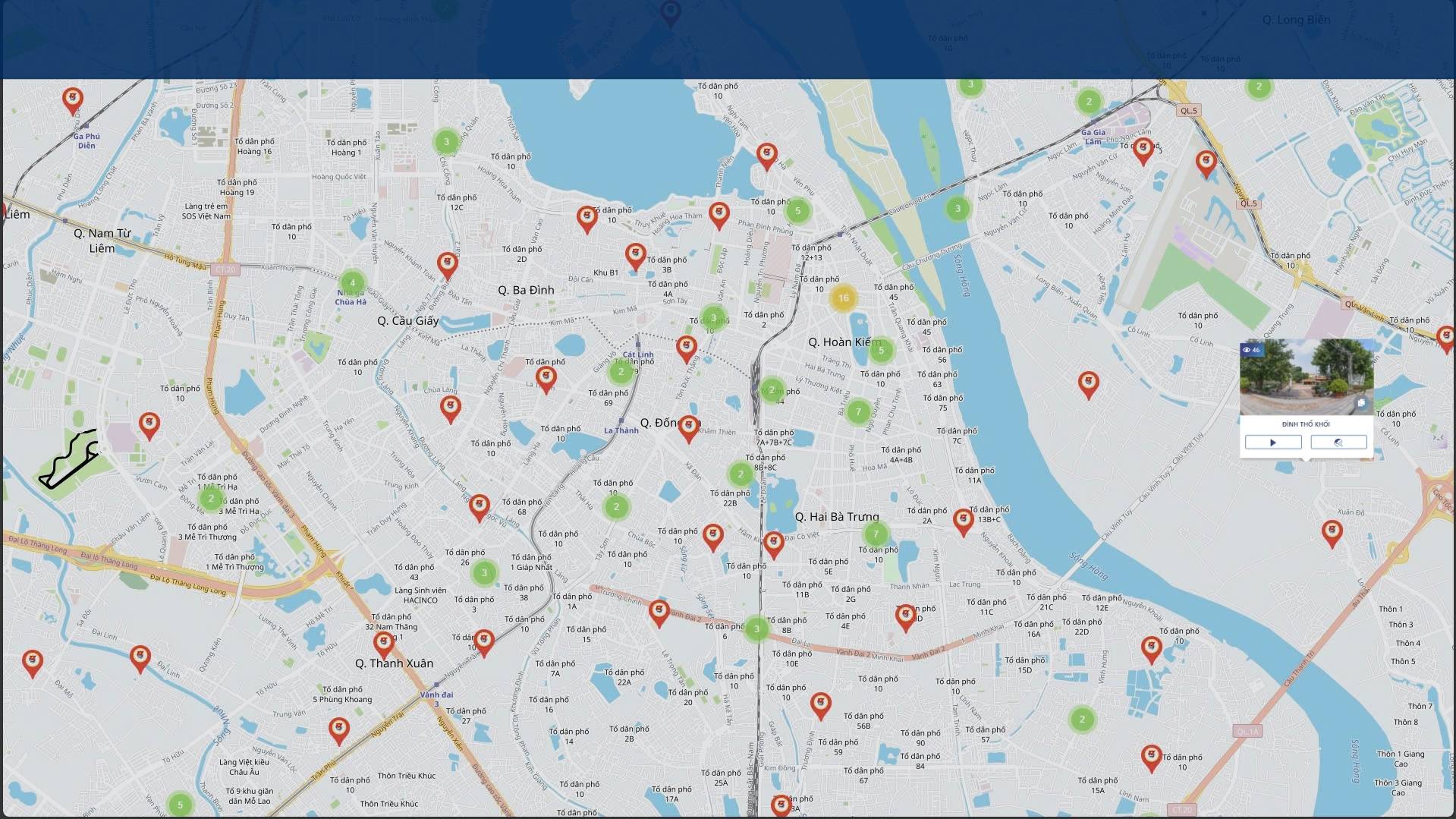
vrSmart Tourism

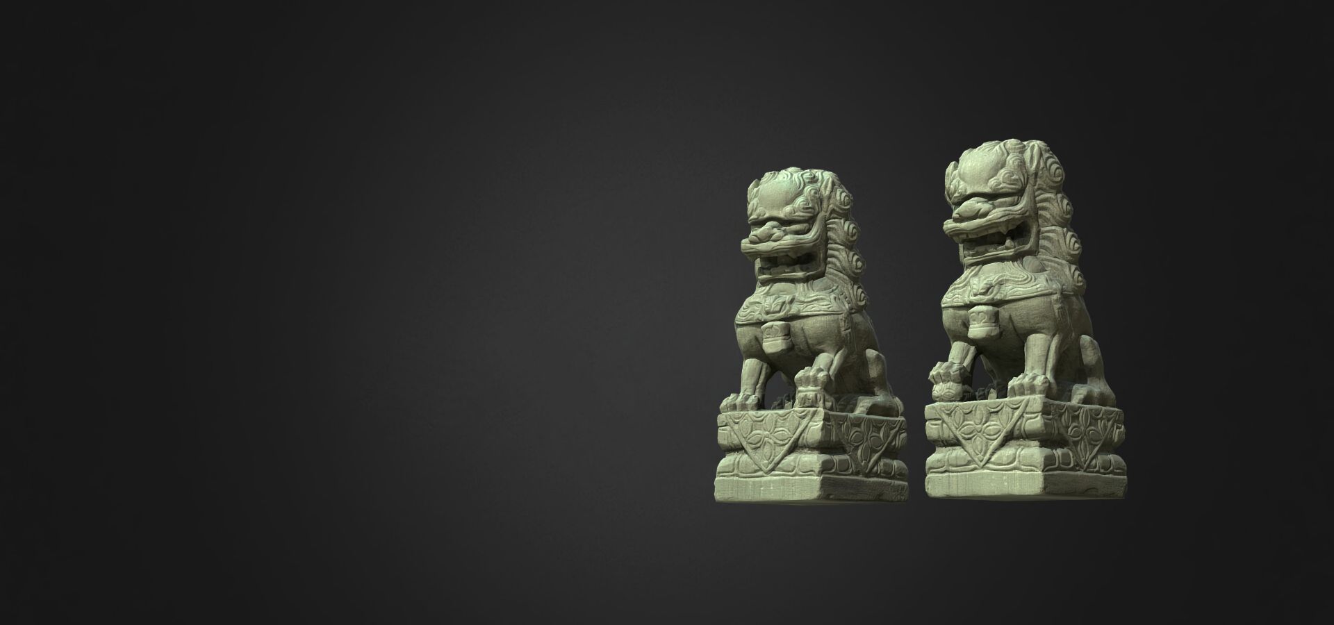
3D Model - AR

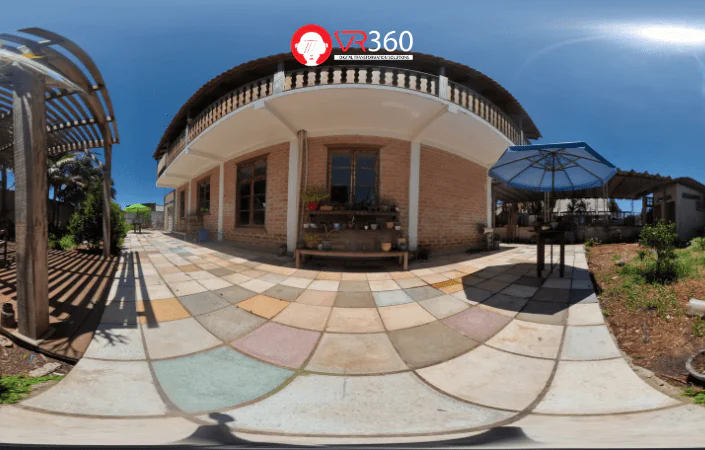
360 Photography

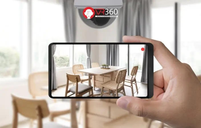
Roomzify

vrMall

About
Unit providing digital transformation solutions applying virtual reality technology
BUSINESS
What line of business are you in?
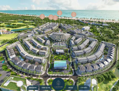
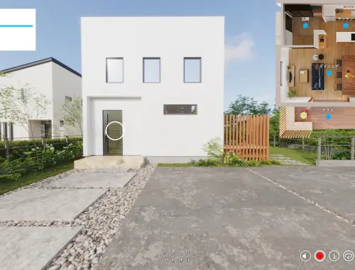
Real Estate
Currently, investors often spend significant time traveling between locations to view various projects. Virtual reality technology offers an excellent solution, enabling investors to save time and conveniently explore the entire project area from anywhere.

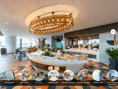
Hotel - Resort
Hotel/Resort managers are often struggling to find effective marketing solutions as customers demand accurate information and realistic visuals. While traditional images and videos may not fully capture the true essence of a place, 4.0 technology can transform the way you connect with your customers.
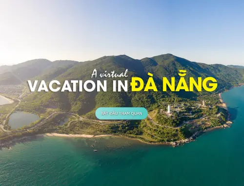
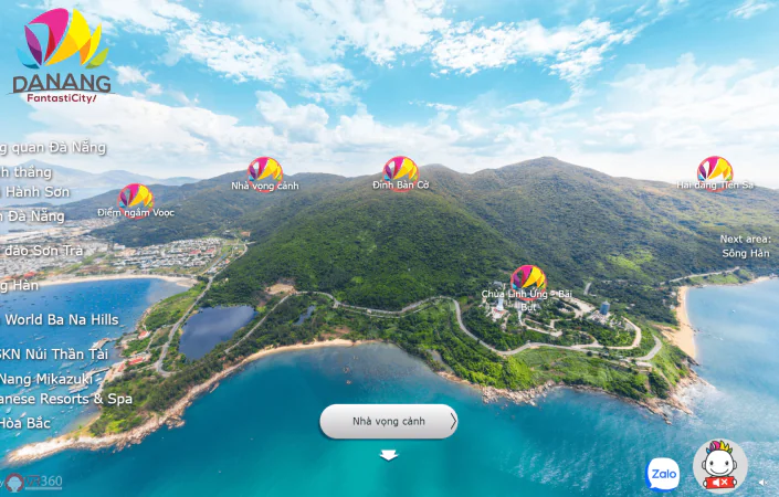
Tourism - Historic Monument
Tourism/historic monument need to create high-quality visual experiences to capture the attention of visitors, thereby attracting large numbers of guests. With marketing solutions powered by technology, you can showcase the most distinctive features of your location.
Architecture - Construction
Design and construction companies are increasingly prioritizing the use of virtual reality technology in their projects, as 2D drawings are becoming outdated. They fail to capture the level of detail and convey the full scope of architectural designs. Read the article now to discover the solution.
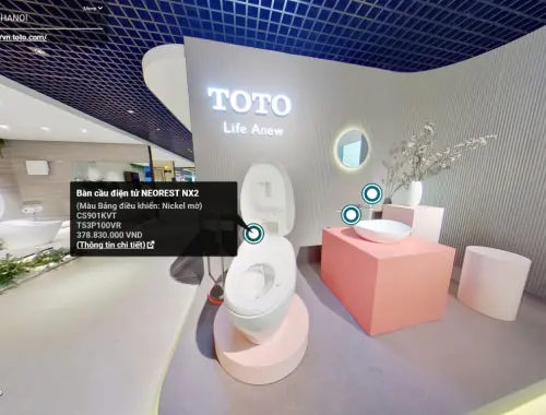
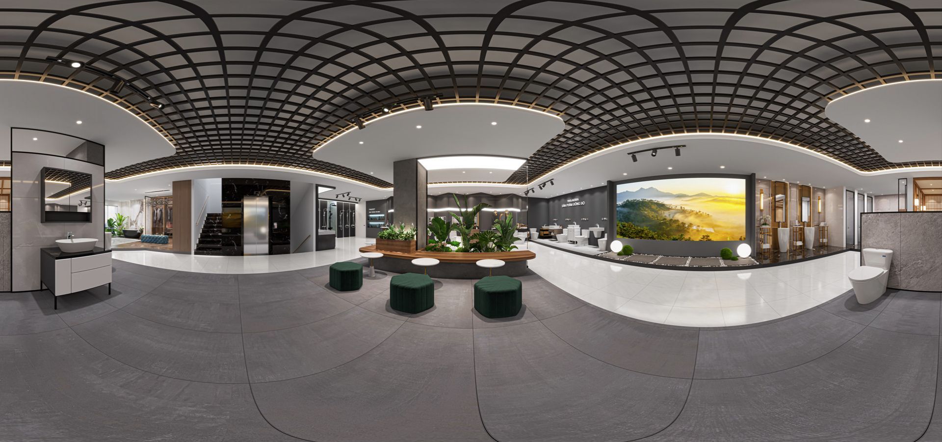
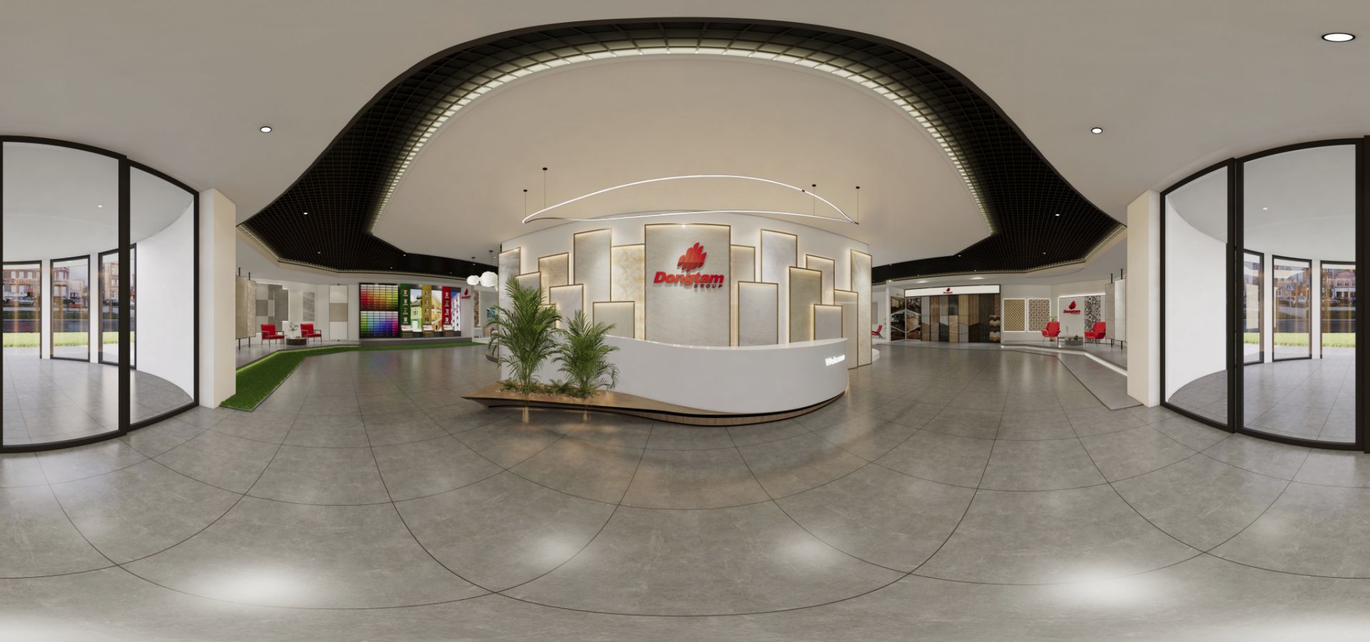
Showroom - Store
Customers are becoming more discerning, demanding showrooms with eye-catching, unique spaces that offer a convenient shopping experience. Creating interactive and immersive displays that allow buyers to directly engage and experience the space will help you build trust and create a positive impression with your customers.
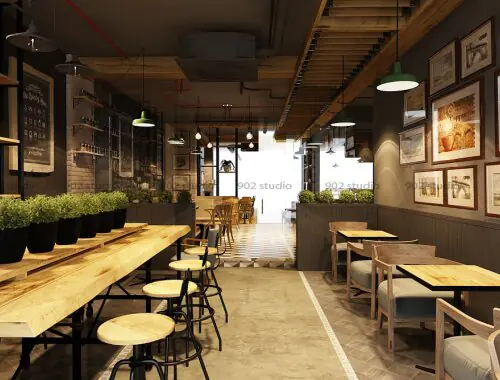
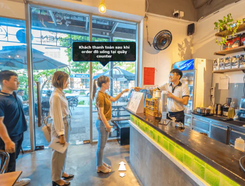
Restaurant - Coffee
One of the key factors contributing to the success of a restaurant or coffee is the attraction of its space design. But how can you effectively market that space to customers? The application of 4.0 technology will help you create exceptional promotional materials.
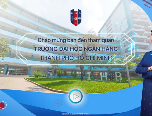
Office - School
Applying virtual reality technology in schools is an effective competitive advantage during the enrollment season. It allows schools to promote their image to parents and students in a realistic and convenient way. Read on to learn more about the potential of this technology!
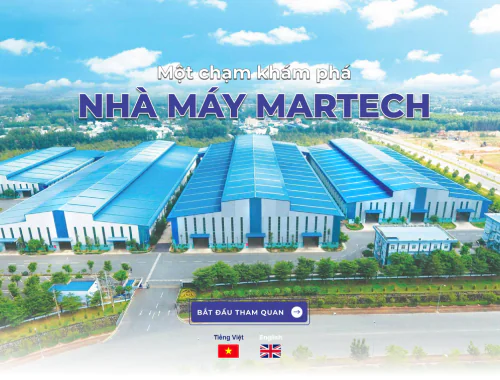
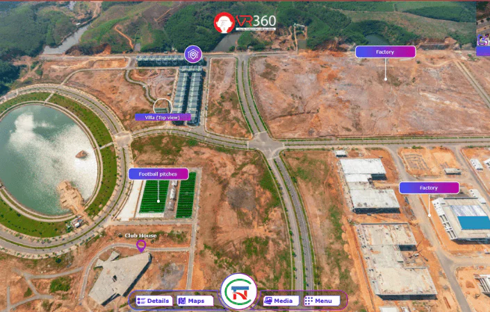
Factory - Industrial Zone
Join VR360 to explore how virtual reality can be applied in factories and industrial zones. How will virtual reality technology benefit the industrial sector in general and individual businesses specifically?
Production - Sale Models
Software and devices play a crucial role in enhancing operational efficiency and business outcomes. Communicating this to consumers and helping them understand and apply these tools is the story of software managers and salespeople. Read on to ensure you don't miss out on this important information!
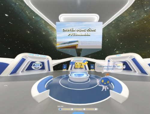
Financial - Banking - Insurance
Continuing the development of science and technology, virtual reality technology is gradually becoming known and has innovative, creative applications across various fields, with finance and banking also being part of this trend. Read on to ensure you don't miss out on this important information!
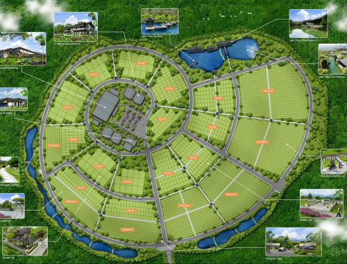
Gardens - Memorial Parks
The application of virtual reality technology is a positive solution for the planning and promotion of monuments and gardens in today’s digital age. Customers no longer need to spend too much time visiting; they can still experience the location through this technology. Read on to learn more about how this technology can be applied.
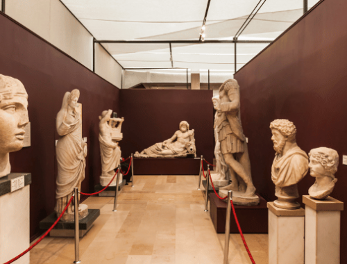
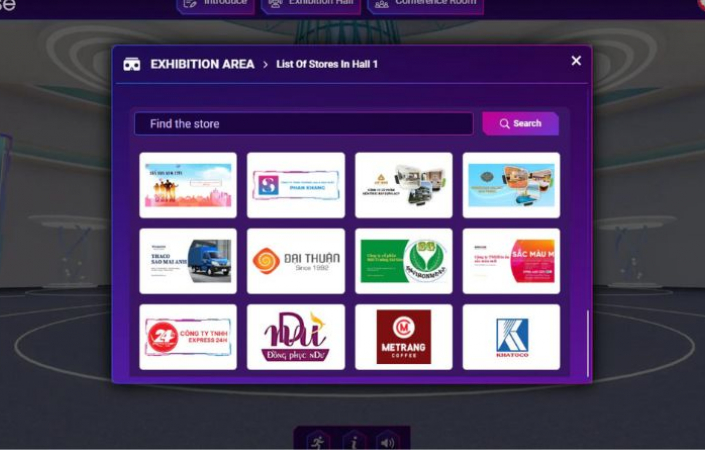
Museums - Traditional Room - Virtual Exhibitions
The outbreak of the Covid-19 pandemic has severely impacted business transactions, with activities involving direct visits to view products being completely halted. The "virtual fair, exhibition, and showroom platform" will solve this problem.
WHY CHOOSE VR360
Services
Featured Projects
WHAT CUSTOMERS SAY ABOUT US
Representative from PVcomBank

Ms. Ha Minh
Che Sach Chinh Ha

Mr. Nguyen Minh Sang
Lecturer at HUB
Mr. Huy
Project Manager

Ms. Truc Mai
U&I Logistic

Mr. Vu Tri Cuong
UK Tech Manager

Mr. Nguyen Phuoc Hau
Meey Land Manager
ACHIEVEMENTS
VR360 ACHIEVED
REGISTER NOW
Article News
Industry news
Số hóa di sản: Giải pháp công nghệ mới hồi sinh di tích lịch sử
 08/08/2023

Du lịch thực tế ảo tại Việt Nam đang diễn ra như thế nào?
03/08/2023
Công nghệ Thực tế ảo VR360 tác động như thế nào đến lĩnh vực bất động sản
02/08/2023
Phân biệt AR, VR, MR và được ứng dụng như thế nào trong đời sống
31/07/2023
Application of Virtual Reality Technology in the Software and Hardware Industry
26/07/2023
Top 5 chiếc kính thực tế ảo giá tốt và đáng mua nhất hiện nay
26/07/2023
Có nên mua kính thực tế ảo? Những lưu ý khi mua kính thực tế ảo
25/07/2023
Tác hại của kính thực tế ảo đối với con người
20/07/2023
Kính thực tế ảo là gì? Cấu tạo kính thực tế ảo và ứng dụng
20/07/2023
3D Side by Side là gì? 3D SBS và các ứng dụng phổ biến
18/07/2023
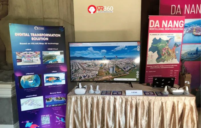
VR360 Tham Dự Hội nghị FIATA RAP, AFFA và UNESCAP 2023
18/07/2023
5 ứng dụng quay video 360 dành cho điện thoại
13/07/2023
Cách quay Video 360 chỉ với 1 chiếc điện thoại thông minh
13/07/2023
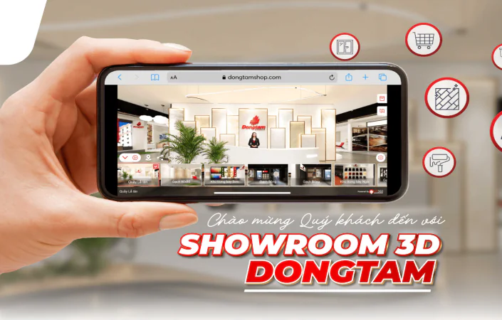
Bàn Giao Siêu Phẩm - Dự Án Showroom 3D Đồng Tâm
11/07/2023
TOP 5 nhà cung cấp dịch vụ thực tế ảo VR360 TOUR tại việt nam
06/07/2023
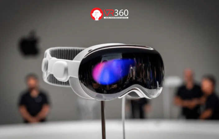
APPLE VISION PRO - Kính thực tế ảo mới nhất của Apple
04/07/2023
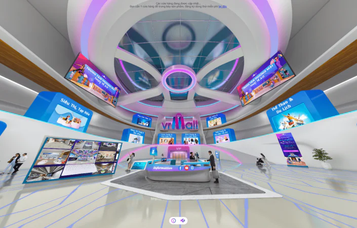
Lí do tại sao doanh nghiệp nên có cửa hàng thực tế ảo vrMall
30/06/2023
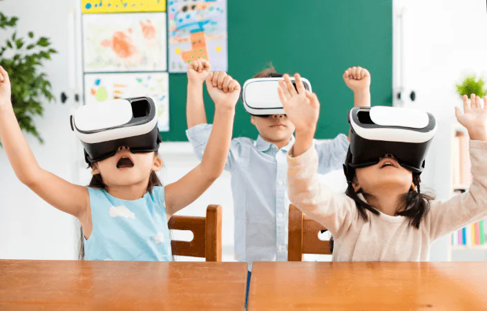
Khám phá xu hướng mới trong giáo dục - chú trọng học tập trải nghiệm
28/06/2023
Mô Hình Du Lịch Ảo - Giải Pháp Quảng Bá Hình Ảnh Mới Cho Doanh Nghiệp Dịch Vụ - Du Lịch
15/06/2023
Typical customers


Sign up to receive information from VR360
Business License Registration Address: 63 Phan Dang Luu, Hoa Cuong Nam Ward, Hai Chau District, Da Nang City, Vietnam